


Overview of Vedic Town Planning
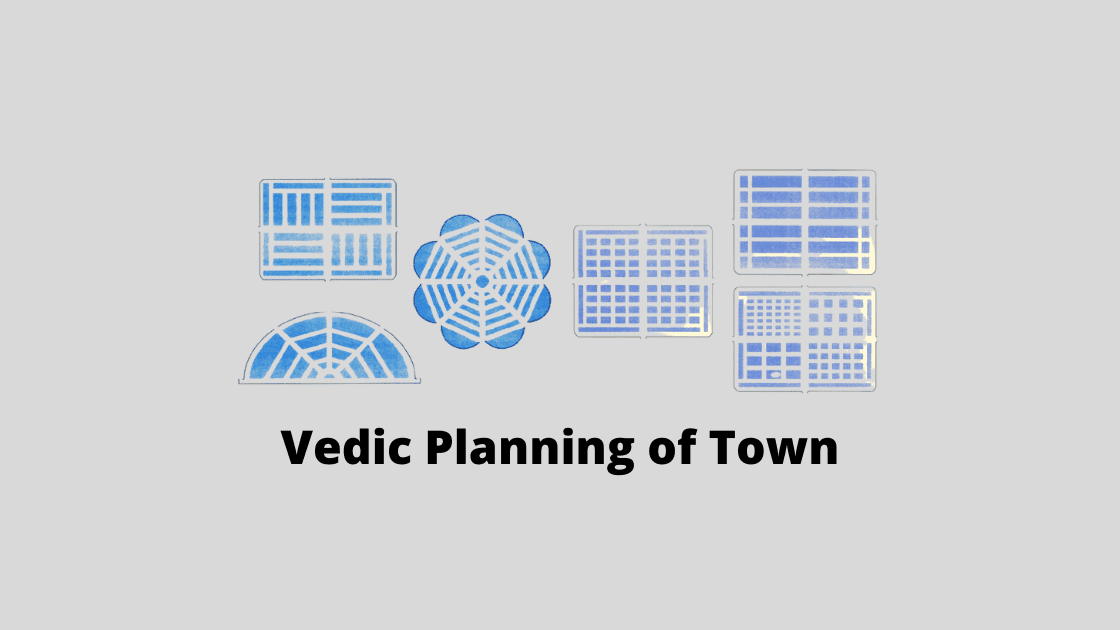
Town planning is the art of guiding and shaping the development of the town by building structures and environment that meets the social, economic, cultural, and recreational need of the residents. Town planning is affected by various factors including physical, social, cultural, economic, political, and ecological. But, apart from all these the planning of town is also affected by the Vastu shastra as per the Indian mythologists and ancient planners.
Vastu shastra or Vedic science of planning and layout is approximately 4000 years old and is a part of Sthapatya Veda which in turn is the part of Yajur Veda. Following the principles of Vastu Shastra, Kautilya described in his Arthashastra, “There shall be sthaniya in the center of 800 villages, a Dronamukha in the center of 400 villages, a kharvatika in the midst of a collection of 10 villages”.

Factors Affecting Town Planning
- The soil condition of the site.
- The climatic condition of the site.
- The topology of the site.
- The direction of the wind.
- The sun path along with the site.
The ancient towns were generally located along the bank of the river or any other water body. The oblong placement of town helped them to take the maximum use of the water body. The main streets were generally aligned along East-West and the short road along the North-South, with a perception that being located in east-west directions the streets would get purified by the Sun’s rays. And the roads surrounding the town were specifically made for the priests. A typical ancient Indian town has a market, streets, residences, temples, royal palaces, public buildings, tanks, recreation centers, and the city fort.

The Eight Ancient Towns in India according to Mansara’s Text
Dandaka
In the Dandaka style of planning, the streets are straight and cross each other at an angle of 90° at the center, having a width of one to five dandas (1 Rajju = 10 Dandas = 60 Feet). The village office is situated in the east, and the village has four entry gates, each on the four sides of the rectangle or square. The single row of houses is located at the extreme ends of the village. Gandevata, the female deity is located outside the village while the male deity is in the northern part.
Example – Indus Valley Settlement of Mohenjodaro and Harappa

Sarvatobhadra
The Sarvatobhadra style of planning is seen in larger towns or villages, which are developed on a square site having access from all four sides. The entire town is occupied by a variety of houses and is inhabited by all classes of people. The town is dominated by the temple.
Example – Thanjavur, Tamil Nadu

Nandyavarta
The Nandyavarta style of planning is mostly used in the development of circular or square towns with 3000 – 4000 houses. Here the streets are parallel to the central adjoining streets with the temple. The temple of the presiding deity is placed in the center of the town. As the name suggests, ‘Nandyavarta’ (meaning flower), the form of the town follows the floral pattern.
Example – Madurai

Padmaka
The Padmaka style of planning is used for building a fortressed town. The pattern of Padmaka replicates the petal of the lotus radiating outward from the center. This type of plan has no further scope of expansion, as it is surrounded by water bodies.

Swastika
The Swastika style of planning has some diagonal streets dividing the entire site into rectangular plots. Two main streets are crossing each other at the center, running from west to east, and south to north. The site can be of any shape, and need not be marked out only as a square or rectangle. In Swastika, a rampant wall surrounds the village or town, with a moat at its foot filled with water.

Prastara
The Prastara style of planning has either rectangle or square site and not triangle or circular. The site is divided based on poor, middle class, rich, and the very people. Hence the size of the site increases depending upon the class and the affordability. Fort surrounding the town is not compulsory here. The main roads are comparatively much wider than any other style of planning.
Example – Prastara

Karmukha
The Karmukha style of planning is in the form of a bow or semi-circular or parabolic. It is mostly applied in the towns situated on the bank of the river or at the seashores. The main streets running from north to south and east to west, radially meet at the center of the town, hence dividing the town into blocks. The female deity is the presiding deity here, installed in the temple built in a suitable place.
Example – Shahjahananbad and Kaveripattinam

Chaturmukha
The Chaturmukha style of planning is applicable for all types of areas, from the largest town to the smallest village. The site can be either rectangle or square. The presiding deity’s temple is situated at the center of the town. The town runs from east to west with four main streets.

Final Words
Similar to the Mansara Text, the Kamikagama text describes another 15 types of settlement. The Kamikagama text also describes towns and villages as srivatsa, vaidika (both as auspicious), paraga (cob-webbed), and prakarnaka (fan-like) among other classifications including the above 8 types.
The development and planning of the town are meant to provide healthy conditions for both rich and poor to live and work and relax. And this Vedic planning has always helped the town to grow and prosper if developed and maintained properly.

 K
K Unlocking the Power of Feng Shui in Real Estate: A Guide to Harmonizing Your Home
Town planning is the art of guiding and shaping the development of the town by building structures and environment that... K
K What is External Development Charges (EDC)?
Town planning is the art of guiding and shaping the development of the town by building structures and environment that... K
K Importance of Highway for Indian Real Estate Sector
Town planning is the art of guiding and shaping the development of the town by building structures and environment that... K
K Ways to Manage Traffic in Metro City
Town planning is the art of guiding and shaping the development of the town by building structures and environment that...
What is Travel Demand Modeling?
Town planning is the art of guiding and shaping the development of the town by building structures and environment that...
What are CPM and PERT?
Town planning is the art of guiding and shaping the development of the town by building structures and environment that...
Overview of Vedic Town Planning
Town planning is the art of guiding and shaping the development of the town by building structures and environment that...